Now on Twitter and Instagram
Follow the HHA! You can now stay connected to the news, volunteer work, trail advocacy and adventures of the Haney Horsemen on Twitter (@HaneyHorsemen) and on Instagram (haney_horsemen_association) .

In Memoriam: Bill Archibald
June 20, 1929 – February 3, 2020
We are sad to share the news of the passing of our “Trail Boss” Bill Archibald.
Bill’s contribution to the equestrian community was tremendous. Through decades of unwavering trail advocacy and leadership, he helped Maple Ridge achieve the unrivalled distinction as the Horse Trail Capital of BC. He was a dedicated volunteer and an inspiration to many in the way he put his passion for horse trails into action for the benefit of us all. We are forever grateful.
Read more about Bill’s accomplishments in this article from the Maple Ridge News (March 3, 2020):
“Maple Ridge bids adieu to its Trail Boss”

Website Renovation in Progress
Please bear with us as we migrate our site to a new hosting provider. Some pages and features are not yet fully restored. Thank you for your patience!
Fall 2019 Membership Special
NEW or RETURNING MEMBERS:
Join now for the remainder of 2019 and enjoy automatic renewal through to December 31, 2020 for just $20 (individual) or $40 (family).
Visit the membership page for application & payment details.
Santa Claus Parade in Maple Ridge

Taking place on Saturday, December 7, 2019, HHA will be participating in the Maple Ridge Santa Claus Parade. Assembly time will be at 5:30pm (parade starts at 6pm) and HHA welcomes more volunteers, both for float decorating and for during the parade. Volunteers will be needed for carrying our banner, walking beside the float at the four corners (for safety) and, of course, riding on the float. We plan to bring miniature horses to accompany the float, and maybe a llama or two? The HHA float planning meeting will be on Sunday, November 17. HHA members interested in joining in the fun will find parade planning details/contact info in their email inboxes; or contact info@haneyhorsemen.com if needed.
NOTICE: Unstable Gravel Shoulder at Fern Crescent

Beware the very soft gravel shoulder at the northwest corner of 128 Ave and Fern Crescent. With recent heavy rains, it has destabilized.
This past week, a horse and rider fell into the 2-ft ditch when the gravel shoulder gave way under their weight as they stood at the corner waiting to cross Fern Crescent. They suffered some scrapes but were able to carry on after a rest.
As a result, HHA is recommending that riders ride on the south side of 128th Ave; it has less space, but is more solid.
Please be very vigilant with regard to the footing and traffic. HHA will be sending a report in to the city about this hazard.


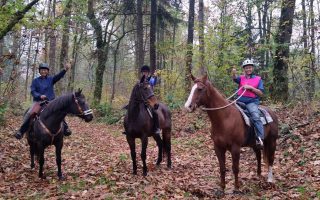
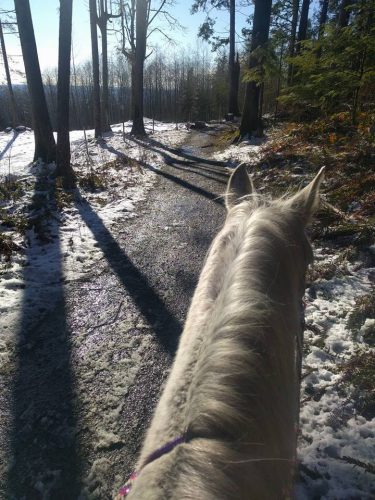
Heritage Trail: George’s Way Trails

The George’s Way Trails, in the Thornhill area of Maple Ridge, are horse trails of historical significance to the Maple Ridge community. In February 2019, the George’s Way Trails were awarded Heritage Status in the category of Heritage Landscape/Natural Heritage Resource by the Maple Ridge Community Heritage Commission.
The George’s Way Trails are a pair of off-road woodland trails that can be found in the forested urban reserve on Thornhill Mountain between 256 Street and 264 Street, midway up the slope between 98 Avenue (south) and the 108 Street Alignment (north).

Nestled directly south of Kanaka Creek Regional Park, these trails offer easy access within our community for outdoor recreational activities.

For decades, equestrians and hikers have been traversing the George’s Way Trails as their only connection through the forest from the east trailheads of Bear Ridge Trail and Tower Trail at the bottom and top of 256 Street, respectively, to the south trailhead of Thornhill Trail on the 264 Street Road Allowance.

Named for George Fulton, who conceived it and started building it in the late 1960s, this pair of delightful undulating trails meet and separate and meet again as they wind through mixed stands of both deciduous and coniferous trees. On clear days, sunlight dapples the wider gravel sections of this woodland trail brushed on either side by huckleberry, salmonberry and wild blueberry, while some of the narrower, natural-footing sections under the denser tree canopy offer shady respite in the mossy carpet border to native ferns, bunchberry and trillium.


George Fulton began the trail development by repurposing an old logging road as the foundation for what would become the “Lower George’s Way” horse trail. Soon after, an alternate path for winter season riding was built that arched northward (called “Upper George’s Way”, but also known anecdotally as “George’s Highway”), as the surface of Lower George’s Way had some sections that became too wet and soft under the heavy winter rains. In 2002, during the refurbishment of a culvert at James Creek that required removal of the trail surface, the original skid road from the old logging days was found a few feet down, its timbers in remarkable shape having been preserved in the clay.
Maintenance of the George’s Way Trails was continued by George and Mary Fulton’s daughter, Pauline, along with other member-volunteers of the Ridge Riders (aka “Haney Horsemen Association” after 1980). This pair of trails are among those that the HHA registered with the District beginning in 1982, and trail stewardship of the George’s Way Trails by the HHA continues to this day.
A large part of the network was resurfaced in the 1990s during a volunteer-led work bee and the reopening celebration welcomed Pauline back, all the way from Ottawa, to ride the trail with the HHA.


Not just the horse community but all of Maple Ridge owes a debt of gratitude to the Fulton family for their foresight in recognizing the natural significance of this area and the timeless gift of this pair of beautiful trails.
Heritage Trail: Tower Trail

Tower Trail, in the Thornhill area of Maple Ridge, is one of several horse trails of historical significance to the Maple Ridge community. In February 2019, Tower Trail was awarded Heritage Status in the category of Heritage Landscape/Natural Heritage Resource by the Maple Ridge Community Heritage Commission.
Tower Trail was created in the late 1970s by volunteers from the Ridge Riders (aka “Haney Horsemen Association” after 1980), and is one of several trails that the HHA registered with the District beginning in 1982.

For over 40 years, Tower Trail has been a primary connector in the Maple Ridge horse trail network; the trail route gradually climbs the north slope of the forested urban reserve on Thornhill Mountain between 252 Street and 260 Street, providing equestrians and hikers with off-road access up and over the mountain’s peak to connect with the southern Thornhill trails.

Tower Trail was aptly named because of the easily-visible landmarks of the BC Tel Towers at the top of the hill (256 Street) and the Cable TV towers, and later, the radio repeater towers. Towers are located at the peak and approximately 200 m down the southern slope.
Tower Trail has been maintained over the decades by HHA volunteers. Among the HHA members whose volunteerism was critical to the development of the Thornhill sections of the Maple Ridge horse trail network is Dave Smith. As his Tennessee Walking Horse breeding and training facility, “Tower Ridge Farm”, was located in the area, Dave and his wife, Debbie, frequently rode the Thornhill area trails for the fitness training of their young horses and for recreation with their fellow equestrians.
Dave emerged as a formidable leader in the stewardship for all trails of the Maple Ridge horse trail network, serving as HHA president for a time, and was a founding member of KEEPS (Kanaka Education and Environmental Partnership Society). His passion was particularly apparent in his home neighbourhood, where his efforts to maintain Tower Trail complemented his work on neighbouring Bear Ridge Trail to the south, another key route of the horse trail network that travelled along the southern lower slope of Thornhill Mountain. Dave’s tenure with the HHA lasted for over 30 years; in 2012, the Smiths retired and relocated to the BC interior.
In its role as a primary connector on the north side of the forested urban reserve on Thornhill Mountain, Tower Trail serves two important functions in the horse trail network. It provides equestrians with forested, off-road access on the north slope of Thornhill Mountain, via the 108 Avenue and 110 Avenue Road Allowances between 252 Street and 260 Street; secondly, it branches to a southward series of switchbacks that serve as a forested, off-road uphill connector to the mountain’s peak. This key set of switchbacks originally offered two forks to connect with 256 Street; the first exited at the peak of Thornhill Mountain into a forest clearing adjacent to the uppermost tower on 256 Street, while the second avoided the full-elevation climb by traversing a path around the slope to exit onto 256 Street at the lower tower site, about 200 m south of the peak.

Prior to the construction of Tower Trail, equestrians could only scale the hill via the steep gravel service road of 256 Street, northward from 104 Avenue. The west-most trailhead at 108 Avenue and 252 Street is a very steep access/exit point for Tower Trail that is convenient for trail maintenance; with the recent nearby housing development, the natural horse trail here has been replaced by several short asphalt and gravel switchbacks to also function as a service road for the subdivision.


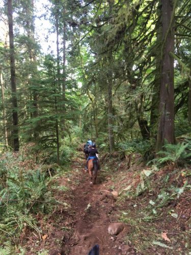
From the trailhead at 260 St/Grant Ave, this woodland trail begins rising immediately, twisting and turning as it climbs the mountain.
Many equestrians embrace the challenge to their skills and their horses’ abilities on this east end of the trail, tackling the natural steps formed by exposed tree roots and clusters of tumbled boulders but also enjoying the relief of the soft soil on the brief level sections in between the obstacles.
Here, a natural barrier remains on either side of the narrow trail from decades of fallen branches weaving together into a moss and lichen-covered tangle; a rest to take in the view of the deeper forest of western red cedar and big leaf maple reveals clumps of tall, lush sword ferns sprouting from every cleft.
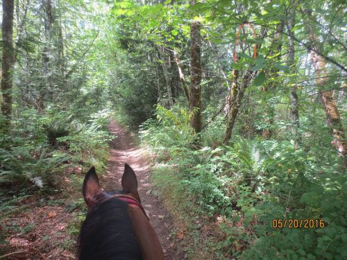
As the trail wraps around the north slope of Thornhill mountain, it widens a little and the grade eases; from this point onward, the natural forest-floor of duff – that blend of fine woody debris, conifer needles and leaves – provides comfort under foot for horses and hikers alike, and maintains its stability year-round, thanks to the mountain’s gradual north-draining slope at that elevation.
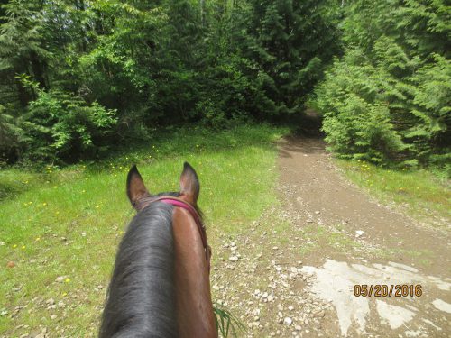
Turning south, the switchbacks begin; in the approach to the peak, the forest canopy opens up slightly, and the greater light reaching the forest floor supports salal, mahonia, salmonberry and many horses’ favourite snack – huckleberry.

The southeast-trending forks off of the switchbacks return equestrians and hikers down to the denser forest on the route to the two southern trailheads halfway along the mountain slope on 256 Street, while the climb to the peak continues to brighten, all the way to the open plateau at the top, which is ringed by a thicket of thimbleberry, flowering currant and blackberry in summer.
The final segment of Tower Trail at the peak is a short dip through the tall cedars to the west trailhead at the north end of 256 Street.

Heritage Trail: Bear Ridge

Bear Ridge Trail is one of several horse trails of historical significance to the Maple Ridge community. In February 2019, Bear Ridge Trail was awarded Heritage Status in the category of Heritage Landscape/Natural Heritage Resource by the Maple Ridge Community Heritage Commission.


Bear Ridge Trail was created in the 1970s by George Fulton and his family. The Ridge Riders (aka “Haney Horsemen Association” after 1980) were among some of the first users of this new trail. Bear Ridge is one of several trails that the HHA registered with the District beginning in 1982.

The trail’s name, as the story goes, acknowledges the old Boar Bear that lived in the area and was often seen sunning himself near the trail. Not surprisingly, this trail was used as a training ground for many horses to get them used to the sight and smell of bears.

Dave Smith emerged as a formidable leader in the stewardship of Bear Ridge Trail, complementing his efforts for the neighbouring Tower Trail that climbed up the north side of Thornhill Mountain to the peak. In the 1990s, the property changed ownership and Bear Ridge Trail became a logging road allowing trucks to remove the trees. Dave Smith recalls the relocation of the trail to the south, closer to the 104 Avenue Road Allowance, due to the logging work going on. Always a leader in organizing trail-building work bees, he tells of cutting out logs, grub-hoeing switchbacks and persevering against cold and wet weather.
Equestrians and hikers alike have been traversing Bear Ridge Trail over the last four decades as their primary west-east connection from the horse trails near 248 Street (Westview and Erskine trails) through the southern section of the forested urban reserve on Thornhill Mountain to 256 Street.
Two east trailheads for Bear Ridge Trail were “twinned” across 256 Street with the corresponding west trailheads of the George’s Way network (Lower George’s Way for summer season riding and Upper George’s Way for winter season riding). Anecdotally, Bill Archibald would refer to the branch for Bear Ridge trail directly west of Upper George’s Way as the “cross cut trail”; the northeast trailhead for Bear Ridge meets the west trailhead of Upper George’s Way at 256 Street, about 450m north of 104 Avenue. This branch provided a continuous winter season route for both hikers and equestrians from Upper George’s Way (aka “George’s Highway”) to the main section of Bear Ridge Trail.

Bear Ridge Trail is a narrow trail, shaded by the tall coniferous forest canopy, that gently parts the evergreen glade of ferns as it winds along the southwest base of Thornhill Mountain. Equestrians and hikers cherish the trail’s natural forest-floor of duff – that blend of fine woody debris, conifer needles and leaves – for its comfort under foot, as well as the interest and traction provided by the clusters of exposed river rock and tree roots on the small hills.
Moss and lichens hang in drifts off the lower branches of the oldest trees and fungi sprout in many unexpected places, in a wide variety of unique, photo-worthy shapes. The western end of the trail is brighter due to more recent logging of the neighbouring properties; there, huckleberry, thimbleberry and salmonberry thrive in spring and summer, providing opportunities to those riders and hikers whose pace and reach are both “just right” to sample the sweet, tangy delights of the trail.

Thornhill Trails Granted Heritage Status
Three historic horse trails in the Thornhill area, built by the HHA, have been awarded Heritage Status by the Maple Ridge Heritage Commission: George’s Way, Tower Trail and Bear Ridge Trail.
We thank all of our Haney Horsemen pioneers, with leadership from David John Smith, Bill Archibald, and the late Sherman Olson for their vision and efforts over the last 50 years to build, maintain and protect these routes for future generations. Ensuring the preservation of this network of beautiful trails as a natural heritage resource for future generations is the HHA’s top priority.
The Maple Ridge 2019 Community Heritage Awards ceremony was held on Feb. 21. Our nominees, George’s Way, Tower Trail and Bear Ridge Trail, were each honoured and recognized in the category of Heritage Landscape/Natural Heritage Resource.
Our equestrian community club’s passion for trail stewardship has deep roots and our decades of commitment to the municipality has succeeded in making Maple Ridge the “Horse Trail Capital of British Columbia” (see http://www.haneyhorsemen.com/historical-legacy/). The record of volunteerism by long-serving members of the HHA is unmatched by any other community group in Maple Ridge’s history of outdoor recreation.
Read more about the 2019 Heritage Awards in the Maple Ridge-Pitt Meadows News: https://tinyurl.com/y5ohvp6p
View more photos from the Awards Ceremony and images of the Heritage Trails in the Photo Gallery on this website.


